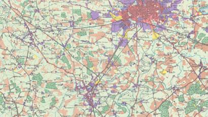
Ever since the first vegetation maps at the turn of the 20th Century, there have been many attempts to develop a system for measuring change in the countryside. Early approaches include the first Land Utilisation Survey of Great Britain, undertaken by L. Dudley Stamp in the early 1930s, which along with other studies helped form the basis for the initial selection of national nature reserves from the 1940s onwards.

In 1948 the Nature Conservancy was created and charged with establishing and managing national nature reserves. Its first research station was opened at Merlewood, Grange over Sands in 1954, at a time of increasing awareness among ecologists of the need to place ecological science on a more exact or quantitative basis – ie. involving analysis of statistical amounts, rather than relying on expert judgements alone.
1960s: Second Land Utilisation Survey of Great Britain
The Dudley Stamp survey was repeated, led by Alice Coleman, but with increased definition in the cover categories. Both surveys relied mainly on the publication of maps to disseminate their results and provide information, even though they were initially intended to continue the inventory established in the Domesday Book.
1971: National Woodland Classification
The need for a National Woodland Classification provided opportunity to encourage a more quantitative approach to vegetation survey. The initial purpose of the Classification was to provide a basis for the woodland component of the Nature Conservation Review (NCR), published in 1977 - itself the most ambitious assessment ever undertaken of a nation’s wildlife resources. A pilot study of some 200 woods in the Lake District proved sufficiently encouraging to prompt statistical analysis of data from the NCR for the whole of England. Data was punched onto tape at the Nature Conservancy, Merlewood and transferred by the Atlas Computer at Cambridge University into a card format suitable for the computer at Southampton University, the only one capable at that time of handling such large datasets.
The analysis resulted in the classification of 557 vegetation types, along with a broader and more ‘manageable’ classification of 103 types. A field survey of each of the 103 vegetation types was made in 1971, using a standardised procedure - providing for the first time an objective measure of the national range of woodland types.
1974: The Cumbria Survey
In 1973 the Nature Conservancy was abolished and a new Nature Conservancy Council (NCC) established in its place. The former Research Branch of the Nature Conservancy remained within the Natural Environment Research Council (NERC), becoming the larger part of the new Institute of Terrestrial Ecology (ITE).
A priority for ITE was to extend its expertise in sampling and data analysis to the wider environment. In 1975 the Cumbria Survey was launched as the first major project in the UK to test the full methodology of environmental classification, as the basis for assessing the vegetation resources of a region. Following visits to a random sample of 1km squares, analysis showed that the vegetation classes were strongly and significantly correlated with the land classes. The high correlations meant it was possible to predict the vegetation composition of squares which had not been visited, but where the land class was known.
Reference: J. Sheail & R.G.H. Bunce (2003) The development and scientific principles of an environmental classification for strategic ecological survey in the United Kingdom. Centre for Ecology and Hydrology.
