A number of tools were been developed as part of the Historic Droughts project to view and explore the hydrometeorological, socio-economic and regulatory data developed and gathered within the project.
Image
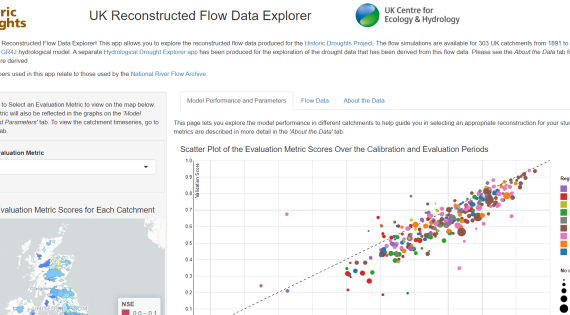
UK Reconstructed Flow Data Explorer
Explore the reconstructed flow data produced for the Historic Droughts Project. The flow simulations are available for 303 UK catchments from 1891 to 2015, and were produced using the GR4J hydrological model. The app shows the model evaluation scores, model parameters as well as the daily flow data in a series of interactive maps and graphs.
Image
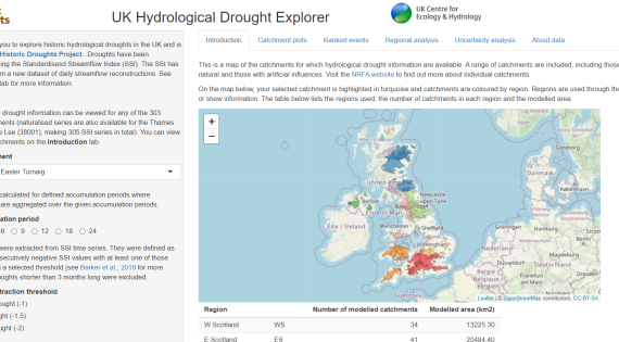
The UK Hydrological Drought Explorer
View the Standardised Streamflow Index (SSI) for 303 catchments across the UK and explore the droughts identified from the SSI, their characteristics and ranks according to their duration and severity in the UK Hydrological Drought Explorer. You can also view the uncertainty in the reconstructed SSI for a selection of catchments.
Image
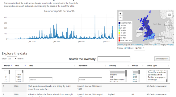
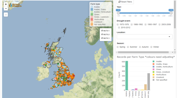
Historic Droughts Inventory Explorer
Explore the Historic Drought Inventory data from a range of sources, including newspapers, legislation, policy, regulation, websites and reports.
Image
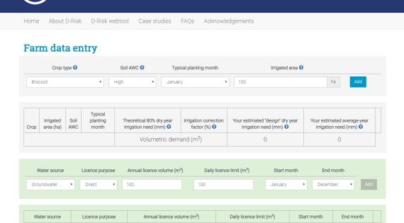
D-Risk
D-Risk is an intuitive and free online webtool to help farming enterprises rapidly understand their business and drought abstraction risks and thereby support robust decisions regarding future investment in irrigation infrastructure, including equipment and storage reservoirs.
Image
The Agricultural Drought Impacts Explorer
Explore the drought references from agricultural media from 1975 to 2018 in the Agricultural Drought Impacts Explorer.
Image
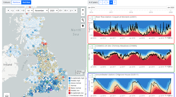
UK Water Resources Portal
The UK Water Resources Portal is an interactive tool to monitor the UK hydrological situation in (near) real-time at a range of spatial scales.
The portal brings together rainfall, river flow, soil moisture and groundwater data in one place, and showcases the use of live river flow data from the Environment Agency and the Scottish Environmental Protection Agency as well as COSMOS-UK soil moisture data.