News and events

Stay Connected. Stay Informed. Shape the Future.

The NC-UK programme is bringing people together to tackle environmental challenges. Over the next five years, we’ll be hosting a calendar of events from hands-on workshops to high-impact conferences all designed to spark collaboration across science, policy, industry, and communities.

Keep visiting this page for the latest updates, opportunities to get involved, and fresh insights from across the UK’s environmental monitoring landscape

Want to stay in the loop?
If you’d like to be kept informed about upcoming in-person and online events, please subscribe to our mailing list.
Image
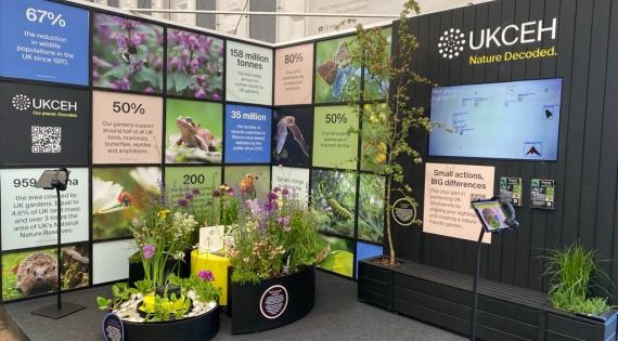
UKCEH's exhibit at the RHS Chelsea Flower Show.

It’s time to take care of spiders, earwigs and other unsung heroes

‘Creepy crawlies’ are quietly helping keep gardens healthy, balanced and thriving by providing important benefits for gardeners and wildlife such as healthy soils and pest control but are under-appreciated and under-recorded say scientists from UKCEH. 

As the RHS Chelsea Flower Show gets under way, UKCEH is asking the public to take an interest in unsung heroes of nature such as spiders, earwigs, woodlice and grasshoppers, by submitting their sightings to support vital scientific research. 

Image
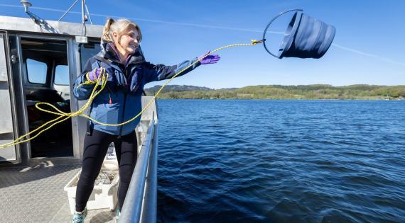
Helen Skelton collecting a water sample from Windermere for UKCEH lake science

Worrying warming trend at Windermere over past 80 years

TV presenter Helen Skelton joins scientists to take part in day of fieldwork.

Long-term monitoring data collected by the UK Centre for Ecology & Hydrology (UKCEH) show that surface temperatures in Windermere, the largest lake in England, have warmed by 1.5 degrees in the last 80 years.

To make its research into rising temperatures and lake ecology more accessible, UKCEH has, for the first time, invited social media content creators, including Cumbrian TV presenter Helen Skelton, to experience its science first-hand at Windermere. Participants undertook real fieldwork, collecting samples, exploring temperature, algal blooms and wildlife, and analysed data in a pop-up lab on shore. 

Helen Skelton said of the experience: “Having this kind of hands-on access to lake science has been amazing. As someone who loves Cumbria, learning what’s happening beneath the surface of Windermere, and why it matters, really brings it home.  
 
“Without long-term data, we simply wouldn’t know how the lake is changing. It’s made me realise how important it is to keep that research going, but also that individuals can play a role too - whether that’s reporting via the Bloomin Algae app or just being more aware. It gives me hope that, together, we can protect Windermere’s future.”


The 2025 dataset from which this summary of findings has been drawn is available from the Environmental Information Data Centre (EIDC).

Image
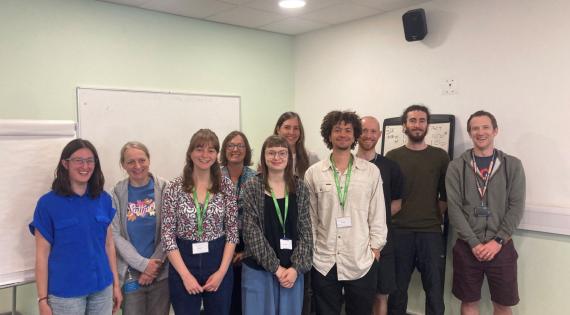
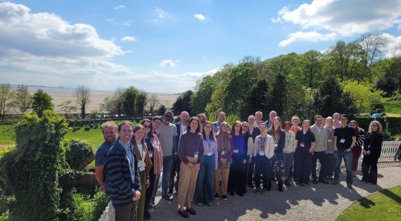
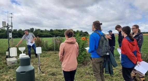
M&M Workshop_Attendee Photo

Monitoring and Measuring Workshop 2 - Habitat Condition

NC UK’s Monitoring and Measuring two-day Workshop brought together key researchers, practitioners and monitoring leads from national organisations spanning the full breadth of habitat condition monitoring – Natural England, Nature Scotland, Scottish Government, JNCC, UKCEH and National Trust.
The two day workshop focused on strengthening environmental monitoring by exploring how data, collaboration and alignment can better support decision making. Through a blend of group discussion and interactive breakout sessions, participants shared experiences and addressed common challenges, including data consistency, long term sustainability, and policy, regulatory and statutory constraints.

A key theme was how monitoring evidence can be more effectively translated into real world impact. 
Discussions highlighted opportunities for deeper community collaboration to align approaches, build on existing monitoring schemes, and strengthen collective practice.
By convening national level expertise in one space, the workshop fostered shared understanding, practical problem solving and a strong sense of shared purpose. 
It marked an important step towards more coordinated, effective and impactful habitat condition monitoring across the UK – a key output from the workshop is the creation of working groups to address some specific problems and funding opportunities together, as part of this UKCEH will step into the role of convener to ensure progress is made.

Image
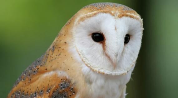
Barn Owl

Predatory Bird Volunteer Network reaches outreach stage

A NC-UK Stakeholder Engagement Fund supported project, the Predatory Bird Monitoring Scheme Volunteer Network has entered its initial outreach stage to identify potential volunteers.  

NC-UK has invested in the formation of a new volunteer network to detect chemical risks to wildlife. For over 60 years the Predatory Bird Monitoring Scheme (PBMS) has measured the concentrations of pollutants in UK native predatory bird species.  

Raptors act as sentinels for our wider environment, often being the first species that persistent and bioaccumulative contaminants are detected. Since its inception the PBMS has relied on the public to submit birds that they have found dead from causes such as road collisions and starvation. However, the persistence and prevalence of high pathogenic avian influenza (HPAI) in UK wildlife has meant the PBMS team has had to look for a novel approach to bird submissions. 

Lee Walker, lead scientist for the PBMS says “Thanks to funding from NC-UK over the two years we’ll be developing a new trained volunteer network”.  

Lee comments further “We’re entering the initial outreach stage to gather expressions of interest from potential volunteers who want to participate in the network. At first, we’ll look to enroll members from the staff of UKCEH and past contributors to the scheme in autumn 2026. This will allow us to perfect our training procedures prior to expanding our call to action to the wider public in future years”. 


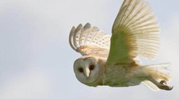
Picture: The barn owl, Tyto alba, is a sentinel species due to its diet particularly prone to exposure to rat poisons. Samples generated through the NC-UK supported PBMS are used in the UK’s Rodenticide Stewardship scheme that aims to reduce wildlife exposure to rat poisons. (c) rhallam www.fotosearch.co.uk 

Image
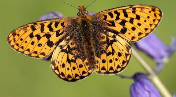
Abundance of Pearl-bordered Fritillary, above, has plummeted 70% since 1976. Photos by Iain H Leach

50 Years of Data Reveal specialist butterflies disappearing Across UK

The UK Butterfly Monitoring Scheme (UKBMS) is jointly run by Butterfly Conservation, the UK Centre for Ecology & Hydrology (UKCEH), British Trust for Ornithology (BTO) and the Joint Nature Conservation Committee (JNCC). 

The data have revealed that species – particularly those relying on specialist habitats – are disappearing from parts of the UK. This is due to habitat loss, pollution and climate change. 

The newly published UKBMS annual results show that despite the UK experiencing its sunniest year on record – weather in which butterflies should thrive – 2025 was only an average butterfly year (20th out of the past 50 years), and not a single species recorded its best year. 

Read more on the UKCEH website

Image
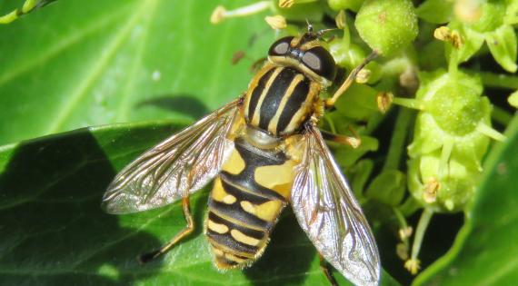
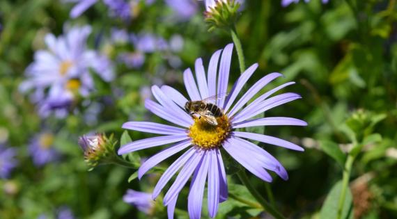
Image: Hoverflies are common in gardens and important pollinators. Credit: Abigail Lowe

The Big British Garden Survey

The National Garden Scheme is inviting people across the UK to take part in The Big British Garden Survey, a new project which encourages everyone to discover and record the wildlife visiting their gardens using simple existing citizen science activities. 

Gardens are vital habitats for a wide range of plant and animal species, yet many are unaware of the extent of biodiversity supported by their outdoor spaces. Collecting wildlife observations not only contributes to ecological research but also offers participants the chance to connect more closely with the natural world, something research shows can benefit wellbeing as well as biodiversity. Anyone with a garden, large or small, an allotment or balcony, can take part. 

UKCEH scientists are working with the National Garden Scheme to deliver the project and will manage and summarise the data collected to help improve understanding of how gardens support biodiversity. 

The survey runs from April until the end of September 2026 with results published by the National Garden Scheme in early 2027.

Get involved using the below UKCEH-developed Citizen Science Fit Count App and spend ten minutes watching flowers and insects in good weather! This simple survey collects data on the total number of insects that visit a particular flower, ideally chosen from our list of 14 target flowers. FIT Counts can be done anywhere, including gardens and parks, in warm, dry weather during daylight hours from 1 April to 30 September.

Image
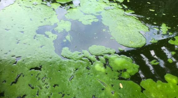
Bright green lumps of algae in dark water

Bloomin' Algae app and how to help.

Blue‑green algae, also known as cyanobacteria, naturally occur in lakes, rivers, canals and reservoirs. During warm summer months they can multiply rapidly, forming blooms and surface scums that may release toxins harmful to people, pets and wildlife.

Bloomin’ Algae is a simple citizen science app that lets you report suspected blue‑green algae when you spot it. Your reports help speed up public health warnings, support monitoring efforts, and protect communities. The app also helps you learn how to recognise algal blooms and understand the risks they pose to children, animals and anyone using the water.

Image
NC-UK Summer Interships

NC-UK Summer Internships 2026

Four NC-UK summer internship projects will begin in June 2026 for a six-week period. The internships will support priority areas of work across the NC-UK programme, while also providing valuable development opportunities for the interns and helping to strengthen links across partner organisations.

The four projects are: 
1.    'Uncovering and minimising barriers to digital research infrastructure in environmental science', led by Kelly Widdicks
2.    'Environmental data visualisation', led by Jacky Chaplow
3.    'Hydrogeochemical sampling and data investigation at UKCEH's Plynlimon research catchments', led by Maud van Soest
4.    'Fine-tuning a state-of-the-art geospatial foundation model for UK land cover classification', led by Jeremy Carter

Image
NEMC 2026

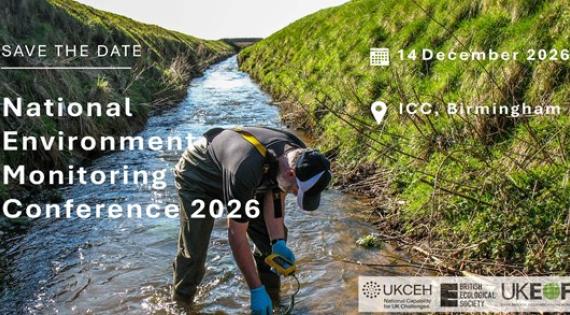
National Environmental Monitoring Conference (NEMC) 2026

The National Environmental Monitoring Conference (NEMC) 2026 marks a valuable opportunity to reconvene the wider monitoring community, share progress, and strengthen partnerships. Building on previous attendance, the conference aims to connect with a diverse range of stakeholders across academia, policy, and practice, highlighting ongoing initiatives and exploring new collaboration opportunities.

Further details to follow shortly.

Image
Future of Monitoring Image

Exploring the Future of Environmental Data

UKCEH has been looking at how rapid changes in environmental data are shaping science and policy, through an NC-UK integrative exemplar project. As part of this work, a three-day futures workshop was held in April in Grange-Over-Sands, bringing together participants from environmental science, technology and policy.

Attendees explored emerging socio-technical trends and developed creative future scenarios, including imaginative narratives about the role of environmental data scientists. Discussions then focused on how these scenarios could inform present and future decision making.

Alongside the workshop, the project team conducted 21 interviews with environmental scientists and policy advisors, examining opportunities, challenges and how these same trends may influence the role of science in policy.

The project has generated a rich set of insights, which will be developed into outputs including illustrated future scenarios and scientific papers. The aim is to help inform how environmental data is collected, integrated and used across the sector.

Image
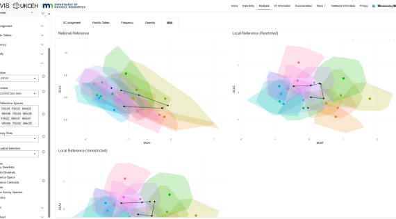
The MVA module of RMAVIS showing plots from the MNNPC St. Croix State Forest example dataset.

New International Collaboration Extends RMAVIS with Minnesota’s Native

We’re pleased to share that the R Modular Analysis of Vegetation Information System (RMAVIS) has now been fully integrated with the Minnesota Native Plant Community Classification (MNNPC), delivered in collaboration with the Minnesota Department of Natural Resources (DNR).

Part funded by NC UK this work strengthens international ties and demonstrates the impact of shared tools and expertise across borders. The MNNPC is widely used by multiple DNR divisions and across federal agencies including the U.S. Forest Service, Natural Resources Conservation Service, National Park Service, and U.S. Fish and Wildlife Service, as well as county land departments, NGOs, educators, researchers, and environmental consultants.

Through this integration, RMAVIS becomes one of the primary ways to access the MNNPC, while also adding new analytical capabilities that were not previously available. Users can now match vegetation plots to the MNNPC, calculate diversity metrics, run multivariate analyses, and generate floristic tables — all within a single, accessible platform.

This collaboration is a great example of how NC UK supported work can deliver meaningful international impact while strengthening tools used by the ecological and conservation community worldwide.

Amy Kendig and Alaina Berger’s time was funded by the Minnesota Environment and Natural Resources Trust Fund, as recommended by the Legislative‑Citizen Commission on Minnesota Resources (LCCMR).

Image
Microplastics concentrated onto a filter for analysis by infrared spectroscopy

Improving Confidence in Microplastics Research

Concerns have recently been raised about the reliability of several high‑profile studies reporting microplastics in the human body. In response, a UKCEH research team has proposed a clear and practical approach for communicating certainty levels in scientific findings. Their work aims to strengthen trust, improve transparency, and support more informed interpretation of microplastics research.

Read the full article to explore the team’s recommendations and why they matter for science, policy, and public confidence.

Image
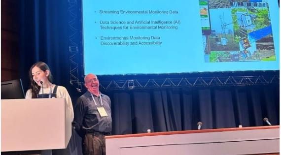
Dri Kelly Widdicks standing at podium presenting with Prof Gordon Blair in from of a screen with presentation on

UKCEH Digital Research Infrastructure (DRI)

Environmental monitoring is rapidly shifting toward digital, automated, and AI‑enabled approaches that improve how data is captured, processed, discovered, and shared. These advances form a growing Digital Research Infrastructure (DRI) that supports faster insights and more integrated environmental science.

UKCEHs latest DRI work across major National Capability programmes, focuses on three areas: streaming monitoring data, applying data science and AI, and improving data discoverability and access. Attendees contributed ideas throughout the session, helping shape future directions in digital environmental monitoring.

Find out more by clicking on the report below.

Image
UKCEH Environmental Science toolbox image

Enhancing Discoverability & Access to Environmental Exposure Data

A Community Conversation about Enhancing Discoverability & Access to Environmental Exposure Data and Methods 

Our most recent National Capability engagement activity in December 2025 highlighted progress on developing a UK Environmental Exposure hub (EEX), a shared resource designed to bring together pollution data with wider environmental, ecological and socio‑economic information to better understand risk to people and ecosystems. Integrating this wide range of dynamic data presents major challenges, including inconsistent formats, scales, standards, quality and access restrictions, as well as technical barriers around interoperability and storage. Rather than each project managing its own data in isolation, the EEX is taking a collaborative approach with the UKCEH Digital Research group and the wider science community to co‑create reusable tools and methods that connect to data at source, support real‑time analysis and reduce duplication. Community Conversations have been used to gather insight, most recently focusing on discovery and access to exposure data and methods, and the project is now in its second year, with a report from this work to be shared soon.

Reports from previous Community Conversations include the Spatial Data Explorer and the Data Science Toolbox

Image
Biological Records Centre logo

Biological Records Centre (BRC) updates

BRC has contributed distribution maps to a newly published field guide, Field Guide to the Grasshoppers and Allies of Great Britain and Ireland by Peter Sutton (Bloomsbury Wildlife Guides). The guide covers grasshoppers, crickets, earwigs, cockroaches, mantids and stick‑insects, providing updated information on species distributions and supporting both expert and enthusiast identification.

To help shape future improvements in species data availability and usability, BRC is inviting all users of UK species occurrence records to complete a short survey. By sharing their experiences, data users can directly influence BRC’s future work on data mobilisation and the development of new biodiversity data products.

Image
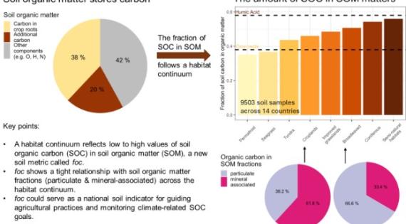
Graphical abstract_Soil organic

A novel indicator to understand soils’ potential to store carbon

Soils are one of the planet’s largest carbon stores, playing a vital role in tackling climate change. But not all soils store carbon in the same way. This research looked at nearly 10,000 soil samples from Europe and beyond to understand how carbon is held in soil organic matter across different habitats—from croplands and woodlands to grasslands and even seagrass beds. 

NC-UK discovered a strong link between soils and vegetation, and the way carbon is stored. By identifying a simple indicator—the fraction of carbon in soil organic matter—we can predict how much carbon soils can hold and how stable it is. This matters because carbon locked in soils helps regulated greenhouse gas emissions to the atmosphere. 

Healthy soils don’t just grow food—they store carbon, protect biodiversity, and make landscapes more resilient. Understanding soil carbon is a big step toward smarter land use and stronger climate action. 

The datasets: https://zenodo.org/records/17305831 and https://catalogue.ceh.ac.uk/documents/29cd5386-bc2e-4d70-a6a5-0d7dc7513dc6  

The blog post: https://ai4soilhealth.eu/providing-a-novel-indicator-to-understand-soils-potential-to-mitigate-climate-change/  

Image
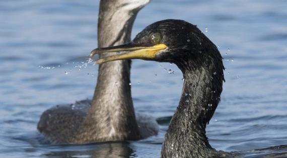
European Shags. Photo Credit Gary Howells

Wild seabirds more likely to split in windy weather
A new study led by Edinburgh Napier University, with UKCEH and BioSS, shows that wild seabirds are more likely to ‘divorce’ and change partners in windier pre-breeding seasons. Analysing 20 years of data on European shags from the Isle of May, researchers found that wind speed had the strongest influence on mate faithfulness, with birds that stayed together tending to breed earlier and more successfully. The findings highlight how climate change could disrupt social behaviours in wildlife.


Seabird breeding success varies across oceans
Separate research involving UKCEH and led by the Farallon Institute reveals that seabird breeding success is declining in the Arctic, Northern European Seas and Northwest Atlantic, but remains more stable in the Pacific and Hawaiian regions. The study, which includes 30 years of UKCEH data on six seabird species, is supported by an interactive tool exploring global seabird-climate dynamics.
 

Image
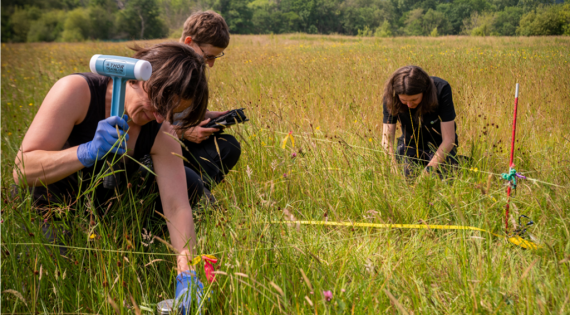
Countryside Survey surveyors in the field

Soil carbon recovery in British croplands

New findings from the UKCEH Countryside Survey reveal the first national-scale evidence of recovering soil organic carbon in British croplands, reversing decades of decline. After losing around 11% of topsoil carbon between 1978 and 2007, cropland soils have shown significant recovery from 2007 to 2020.

This turnaround is linked to shifts in land management practices, such as reduced tillage and straw removal, and marks a hopeful step toward restoring soil health and resilience at scale 2.

Read more via the British Society of Soil Science or access the full study in the European Journal of Soil Science.

Image
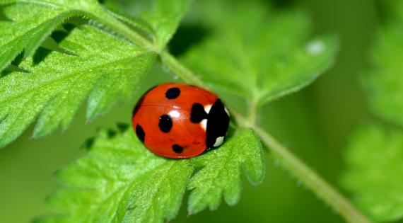
Ladybird

UKCEH database unlocks the secrets of ladybirds

The UK Centre for Ecology & Hydrology supported by NC-UK has just launched a comprehensive Ladybird Traits Database, offering an exciting new resource for researchers, conservationists, and citizen scientists across the UK.
Thanks to this publication, detailed trait data for all known UK species is available in one place covering aspects such as diet, habitat, lifecycle, colour patterns, and ecological roles.

The database supports efforts to improve understanding on species distributions, monitor biodiversity changes, and assess the impacts of climate change and invasive species. It also helps inform conservation strategies and policy decisions by providing accessible, structured data for over 40 native and non-native species.

Dr Helen Roy, a leading entomologist at UKCEH, said:
"Ladybirds are not just beautiful beetles—like all insects they provide essential ecosystem functions including controlling pest insects. This database brings together decades of research and recording effort to help us track how these species are responding to environmental pressures."

The Ladybird Traits Database is part of UKCEH’s broader commitment to open science and biodiversity monitoring. It complements existing resources like the UK Ladybird Survey and supports data sharing through platforms like the NBN Atlas and iRecord.

Researchers, educators, and wildlife enthusiasts are encouraged to explore the database and contribute to ongoing monitoring efforts.

Image
IMLOTS

Ecosystems mediate climate impacts on northern hemisphere seabirds

With the world’s oceans under increasing pressure from climate change and other human impacts, understanding ecosystem resilience is vital. Seabirds are excellent indicators of marine ecosystem health. Protecting the diverse food webs that support seabirds is critical for preserving marine biodiversity and society that depends on healthy marine ecosystems for food, inspiration, and cultural well-being. However, many seabird populations have shown declines in recent decades in association with warming sea temperatures. UKCEH’s long term study of seabirds on the Isle of May, supported by NERC National Capability funding, contributed to a meta-analysis of climate change impacts on seabird breeding success across the Northern Hemisphere, published in Nature Communications Earth and Environment. The team analysed 138 long-term datasets spanning over five decades across seven marine ecosystems. The study revealed chronic declines in productivity in the region where the Isle of May is located (Northern European Seas), as well as in the Arctic and Northwest Atlantic. In contrast, populations in the Northeast Pacific, Northwest Pacific and Hawaiian regions were more stable. Regions with more diverse prey in the diet were buffered from ocean warming, reflecting a “portfolio effect” that promotes higher productivity under changing conditions. However, species in other regions including Northern European Seas had lower diet diversity and are potentially less resilient to environmental change. These findings emphasise the importance of ecosystem processes and structure in determining the vulnerability of marine predators to climate change. The paper shows the power of large-scale data sharing and is complemented by an interactive web platform allowing users to explore the patterns in seabird productivity.

The study is part of the UN Decade of Ocean Science Global Integration of Seabird Time Series project (https://oceandecade.org/actions/global-integration-of-seabird-time-series/). 

Image
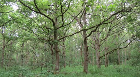
Woodland after 59 years

Help co-design a Restoration Hub

UKCEH aims to co-produce, with the nature recovery practice community, a free to use data and knowledge hub.  The platform will meet the needs and requirements of different stakeholders through activities such as digitising and mapping restoration and rewilding activities and providing data on what is being monitored; species, habitats of interest, extent, wellbeing etc. 

Image
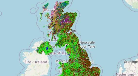
Land Cover Map 2024

Explore how land cover varies between different parts of the UK

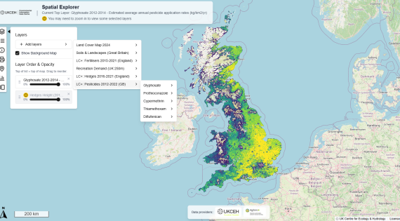
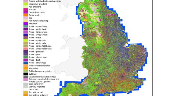
The latest UKCEH Land Cover Map now includes easy-to-access statistics showing how habitats vary across UK counties and nations. Using high-resolution satellite data, the map reveals the distribution of broad habitats—from woodland to urban areas—down to 10-metre detail.

For the first time, users can view land cover statistics without specialist software, making insights more accessible for policymakers, NGOs, water companies and land managers. The data is available in hectares and percentages, and can be explored interactively via our new spatial explorer tool.

Maps and data are free for academic and non-commercial use via the Environmental Information Data Centre (EIDC).

The development of the new dataset and the spatial explorer tool was funded by the Natural Environment Research Council through the National Capability for UK challenges (NC-UK) programme. 
 

Image
UK-BON Image

Towards a UK Biodiversity Observation Network

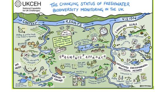
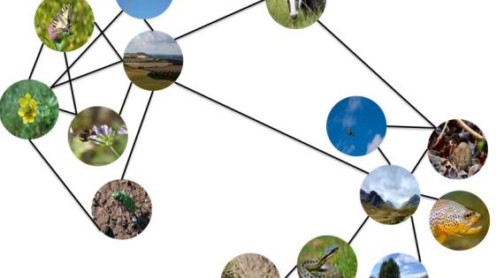
The UK biodiversity monitoring landscape is fragmented: there are many schemes operating in isolation from one another, creating the potential for redundancy and duplication. There is also a disconnect between data providers, end-users and stakeholders. Although the UK is currently the best-monitored nation on earth, our monitoring networks are the result of haphazard evolution. Many nations that lack the UK's historical advantages have begun designing monitoring systems with integration at the core. Moreover, the emergence of new technologies is allowing other nations to build monitoring networks rapidly and catch up. If the UK does not act swiftly, we risk losing our position as the best monitored nation on earth. 

To address this, we need a more integrated approach to biodiversity monitoring. The Group on Earth Observations Biodiversity Observation Network (GEO BON) is a blueprint for integrated monitoring and reporting of biodiversity data across the world and is underpinned by national Biodiversity Observation Networks (BONs). 
We want to create a UK BON, a community of practice to: 
1) bring together users and providers of biodiversity monitoring data, 
2) coordinate biodiversity monitoring to support policy and conservation action and 
3) produce and share knowledge about best practices in biodiversity monitoring.  

If you want to learn more or would like to get involved please get in touch with Francesca Mancini at framan@ceh.ac.uk

Counting the Earth Podcast -Understanding Drought and Weather Extremes

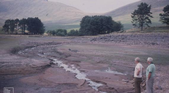
The latest episode on UKCEH podcast Counting the Earth session on whiplash weather explored the increasing variability of UK weather.  UKCEH Senior Hydrologist Lucy Barker discussed recent hydrological conditions and the wider implications of the UK’s shifting climate. Although the latest Hydrological Summary indicated that January had been significantly wetter than average, the session examined whether this was sufficient to restore water reserves following the prolonged drought experienced in 2025.

The episode also included a visit to the COSMOS‑UK field site at Chimney Meadows Nature Reserve in Oxfordshire, where UKCEH micro‑meteorologist Dr Jon Evans provided insights into the national soil‑moisture monitoring network. Chimney Meadows is one of 39 sites contributing data on soil moisture, rainfall, river flows, and groundwater levels. These datasets, gathered by UKCEH and its partners, underpin the monthly hydrological summaries, an essential resource for environmental regulators, government agencies, water companies, researchers, and the farming community.