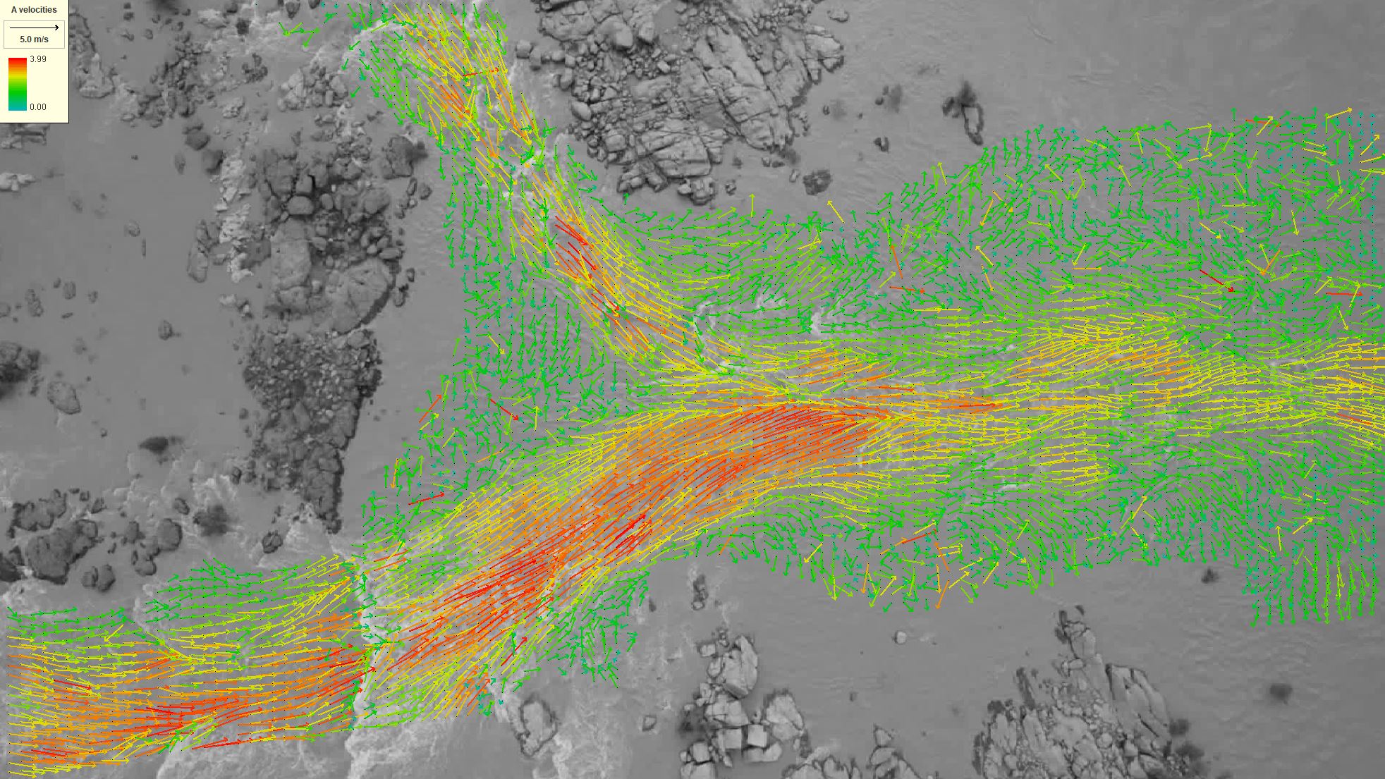
 By enabling flow velocity and discharge data collection from ungauged locations or remote locations, as well as potentially improving the observation of hugely damaging and disruptive overland flows that accompany many major flood events, the method can benefit and complement existing risk reduction and emergency management systems.
Since water flow velocity and discharge estimates are essential to the management of diffuse pollutant fluxes, general water quality monitoring, and water-use for irrigation and recreation, as well as in the modelling and prediction of river morpho-dynamics, the method can benefit environmental regulators and water resource managers.
Finally, as a feasibility study, this project could provide vital insights into the needs and values of possible future sentinel video missions, but more importantly, it can demonstrate the potential value of satellite video imagery for scientific, societal and commercial activities.