We use the Conwy catchment, North Wales (~500 km2) as a long-term, large-scale platform for catchment scale research, modelling and environmental trend detection. The catchment has a wide range of landscapes, facilitating comparative survey and experimental work. We study ecological, biogeochemical and hydrological processes from the gene to landscape scale with an emphasis on developing a holistic understanding of how pressures influence our natural resources and the many benefits which we receive from them. We have accumulated an extensive suite of consistent baseline data which are available to other research projects having more specific aims and objectives.
Integrated hydrological and ecological monitoring and research in a varied coastal catchment
Scientific importance
The Conwy catchment provides a linked terrestrial, freshwater and marine study system at a practical, policy relevant scale, with a wide range of ongoing experimental research, long-term monitoring and modelling activities. The diversity of habitat types and broad range of economic activities provides an ideal platform on which to undertake research into a range of environmental issues including: flooding; water quality; soil health; climate change mitigation; improving biodiversity; development of more resilient land and water-based industries such as farming, forestry and tourism and exploring how these interact at a landscape.
Image
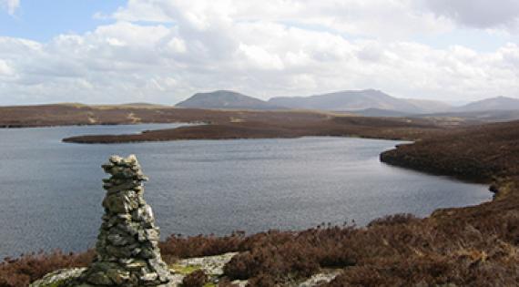
The Conwy catchment.
Characteristics
The main Conwy river drains an area of 380 km2 to the tidal limit, with a further 200 km2 of land draining directly to the 20km long estuary. There is a strong climatic gradient across the catchment with annual precipitation varying between 500mm in the north-east to more than 3500mm falling in the mountains of Snowdonia to the west, which rose to 1064m. The lower and drier east of the catchment is more agriculturally productive, with livestock rearing and scattered native woodland. The higher Snowdonia mountains support limited grazing, plantation forestry and are of high amenity value. Of particular interest is the Migneint, a 200km2 Special Area of Conservation in the catchment headwaters. It is one of the largest areas of blanket bog in Wales and is a major store of carbon. The proportions of major soil classes are close to the Welsh national average, and typical of UK upland areas. Soils are generally neutral to acid, reflecting the geology, which includes no major calcareous outcrops.
The catchment has a range of important habitats: blanket bog; montane and moorland habitats; conifer plantations and woodlands; extensive and intensive grassland; lakes and drinking reservoirs; flood plains and salt marshes. Its uniqueness arises from this wide range of habitats which are a result of a complex mix of geology, soils and historic land use. There is a broad range of engaged stakeholders in the catchment including: water industries (drinking and hydropower); shell fisheries; farmers; foresters; tourist industries; conservation groups and engaged local communities.
Facilities and infrastructure
CEH
- 3 Telemetered automatic weathers stations distributed across the catchment measuring a range of variables: wind speed & direction; air temperature & pressure; relative & absolute humidity; incoming shortwave & net radiation; profile soil temperature & moisture; soil permittivity & electrical conductivity; rainfall
- 11 in situ river monitoring stations with automatic water sampling facilities on the main river and headwaters streams providing continuous data on a range of variables: Stage height & flow; temperature; pH; EC; velocity; turbidity; CDOM; Chlorophyll A; DOC & TOC; NO3-N
Other
- 2 Natural Resources Wales (NRW) flow gauging sites, one near the catchment outlet coincident with a CEH monitoring site (Cwm Llanerch)
- 1 Met Office weather station (Capel Curig)
- 8 additional Met Office rain gauges
- Bangor University operates a network of 30 farms which have been the subject of detailed soil health and fertiliser studies and 12 forest sites.
Ongoing routine data collection
- Weather station data collected every 30 minutes
- In situ river monitoring data collected every 15 minutes
- Daily, weekly and monthly routine river water sampling across the catchment with chemical analysis for a range of variables: pH, alkalinity, chloride, sulphate, suspended solids, dissolved organic carbon, organic and inorganic nitrogen and phosphorus species
Previous Conwy projects include:
- Established field experiments examining the effects of peatland re-wetting on greenhouse gas emissions, the effects of acidity changes in dissolved organic carbon leaching and a 15-year old experiment on the effects of climate change on upland heath shrubland.
- An intensively instrumented riparian hillslope for the study of soil-water chemical, physical and microbiological interaction studies to 5m depth across the land-water interface.
- Monitoring and research in the River Estuarine Transition Zone and linked coastal zone carried out by Bangor University.
- Investigating the response of water quality, biodiversity and carbon sequestration to coupled macronutrient cycling from source to sea (Macronutrients “Turf2Surf”).
- Developing new tools for the detection and surveillance of human pathogenic viruses in freshwater, estuarine and coastal environments (Viraqua).
Project specific data
The Environmental Information Data Centre (EIDC) is a NERC data centre hosted by CEH. The EIDC contains nationally important terrestrial and freshwater datasets. Data collected in the Conwy catchment from a variety of projects (past and ongoing) are stored in the EIDC, and include:
-
General catchment data, including water temperature profile of Llyn Conwy, and spatial water chemistry data.
-
Physical, chemical and biological data (including water quality, soil property and plant physiology measurements) from the Macronutrients Turf2Surf project.
-
Species counts of macroinvertebrates at 19 sites collocated with water quality measurements for 3 annual samplings.
-
Data on pH, turbidity and enteric virus concentrations from samples (water, sediment and shellfish) taken at wastewater discharge points and wastewater treatment plans along the Conwy River.
-
Denitrification and greenhouse gas emissions in natural and semi-natural terrestrial ecosystems.
Modelling
The Conwy catchment is being used as hydrological and ecological modelling platform, with current research strands being:
- The fate and transport of nutrients, bacteria and viruses from source to sea. The JULES model is used to estimate the generation of runoff and water quality output from the soil to the stream network. The Cascade model routes water and water quality components to the estuary, accounting for in-stream processes. Finally, the Telemac model is used to estimates transfers through the estuary.
- The relationship between the terrestrial flora and catchment characteristics. The JULES model is used to estimate local soil properties, and the Multimove model estimates the suitability of the soil conditions for the growth of individual plant species.
- Modelling of ecosystem services in the Conwy catchment, including a model inter-comparison exercise of three of the leading ecosystem service models used in the UK: LUCI, InVEST and ARIES comparing models for water supply, water quality and carbon storage. Modelling work includes applying scenarios of land use change, and exploring the role of landscape structure and pattern in ecosystem service delivery.
Current Conwy Catchment projects (September 2019)
| Project | Funder |
|---|---|
| Environmental DNA (eDNA) | NERC |
| Soil Organic Carbon Dynamics (SOC-D) (UKSCAPE WP-4) | NERC |
| Land Ocean Carbon Transfer (LOCATE) | NERC |
| Environment & Rural Affairs Monitoring and Modelling Programme (ERAMMP; WP-5.1) | Welsh Gov./CEH |
| Fferm Ifan Sustainable Management Scheme (SMS) | Welsh Gov. |
Watch a short video about CEH's work on long-term research platforms including the Conwy Catchment.
Work with us
To discuss opportunities to develop future research and collaborations with CEH in the Conwy, please email David Cooper.