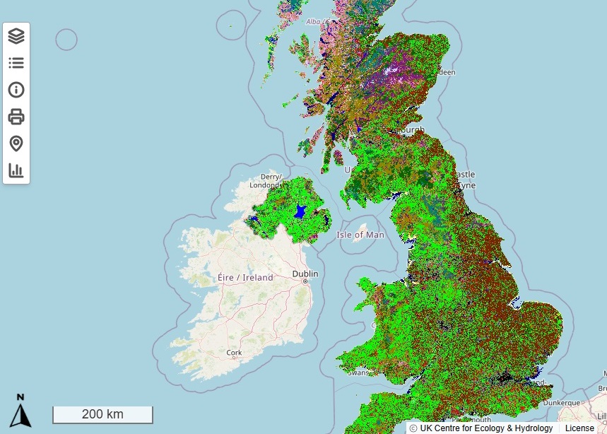
An exciting new addition to the UKCEH Land Cover Map means people can easily see how the makeup of our landscape varies between counties and nations of the UK.
The maps, which we have regularly updated over the past 30 years, use data based on high-tech satellite imagery to show what broad habitats – ranging from broadleaved woodland to arable to fresh water to urban – are where in England, Wales, Scotland and Northern Ireland.
In the highest resolution maps, each pixel represents a 10-metre square of land, which means one can identify narrow features of the landscape such as small woodland patches or waterways.
The latest map, containing 2024 data, was used to calculate statistics for each county (based on Office of National Statistics boundaries) and nation of the UK, and every region in England
Previously, the data had to be downloaded and analysed in geospatial software to extract these statistics. This presented a barrier for some users because it required them to know how to use specialist software.
The statistics data are available in hectares and as a percentage of total land area and enable users to explore how the extent of different land cover types vary across the UK.

Dr Clare Rowland, an earth observation scientist at the UK Centre for Ecology & Hydrology, said: “We are delighted to introduce a statistics dataset with our latest Land Cover Map.
“It shows how habitat extent varies between different areas, enabling policymakers, NGOs and land managers to make more informed decisions when planning future land cover change. This will help ensure we have landscapes that are resilient to climate change and that balance the demands for land for food, housing and biodiversity.
“We look forward to seeing how people use the data.”
You can download the maps via the Environmental Information Data Centre (EIDC) and explore the map interactively prior to download and analysis via our prototype spatial explorer tool there. The tool is being co-designed and developed with the environmental science community, including through a workshop that involved 70 stakeholders.
Land Cover Map 2024 is available at variety of resolutions and formats, to support different analytic tools and user preferences. The raster (pixel) versions of the Land Cover Maps are available free for academic and other non-commercial use.
The development of the new dataset and the spatial explorer tool was funded by the Natural Environment Research Council through the National Capability for UK challenges (NC-UK) programme.
There is further information about UKCEH’s Land Cover Maps, now produced annually, on the project page of our website.