Thank you for your interest in the UK Centre for Ecology & Hydrology project ASTRID, (Assessing Statistical models of Temporary River Intermittence for Decision makers). The project aims to improve the understanding and spatial representation of intermittent rivers in the UK, which are often overlooked despite being a substantial proportion of the river network, and subject to the same pressures as perennial rivers. To this end, we have developed for the first time, national models of the location of hydrological intermittence along the river network.

As the project nears its conclusion on 30 September 2021, we are launching a two-week consultation period for anyone who has an interest in the location, hydrology or management of intermittent and ephemeral rivers in the UK to comment on the results of our modelling.

We would also like to gauge interest in a forum for ongoing knowledge exchange on hydrological intermittence, to raise awareness of the need for wider hydrological monitoring and consistent management of these rivers.

The consultation period is 8 – 20 September 2021.

Please feel free to forward the link to this page – we welcome contributions
 

Recording of the ASTRID results webinar - 2 Sep 2021

The webinar explains the context and reasons for the project, summarises the methodology and results, launches the consultation, and calls for better monitoring of intermittent rivers in the UK.

Maps of modelled hydrological intermittence

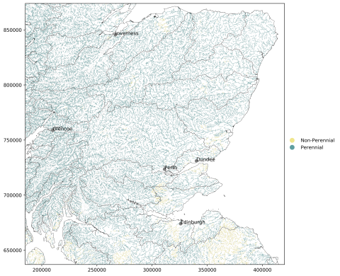
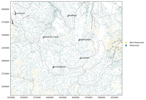
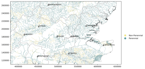
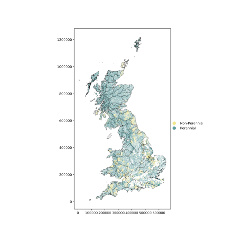
A national map, which is high resolution to allow visual inspection of individual rivers, and three case study regions, with some towns and cities shown for geographical reference, are presented.

Please download and annotate the maps (eg by importing them into Word) or use the survey form to let us know your thoughts on where and how the model is right/wrong.

Image
Results map GB
Click: View larger map of modelled hydrological intermittence - GB
Image
Map of modelled hydrological intermittence - Scotland
Click: View larger map of modelled hydrological intermittence - Scotland


Image
Map of modelled hydrological intermittence – Midlands
Click: View larger map of modelled hydrological intermittence – Midlands

Image
Map of modelled intermittence - Thames
Click: View larger map of modelled hydrological intermittence - Thames

Please return your completed survey and any maps you have annotated to Catherine Sefton at catsef@ceh.ac.uk by Monday 20 September 2021.


For further information, please contact a member of the project team at the UK Centre for Ecology & Hydrology: