We have significant experience in hydrometry, including in the operation and review of gauging station networks, hydrometric monitoring technologies and data management.
UKCEH hosts and manages the National River Flow Archive, mandated by UK Government and the devolved governments of Northern Ireland, Scotland and Wales to maintain and provide information on approximately 1,500 gauging stations nationally. We play an active role in the development of British and International Standards in hydrometry and are engaged in sharing best practice around the world.
UKCEH has established a long-term network of soil moisture monitoring stations for the United Kingdom, known as COSMOS-UK (cosmic-ray soil moisture observing system). The network provides real-time data on soil moisture and a range of other hydrometeorological variables, and we produce a monthly summary of UK soil moisture status that is available to download.
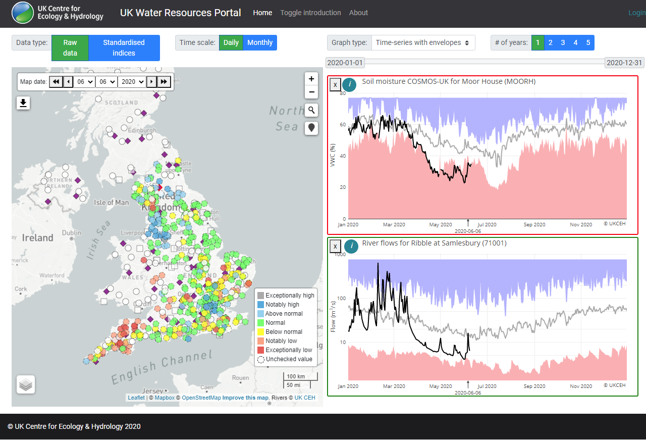
Tool: The UK Water Resources Portal

In 2020, we launched the UK Water Resources Portal, a web-based system for tracking the water resources situation in near-real-time. Like the UK Drought Portal, the tool offers dynamic, interactive situation monitoring, mapping and plotting. However, it encompasses not only rainfall but also river flow, soil moisture and groundwater levels. River flow and soil moisture, data are updated daily.
The portal provides access to: rainfall data from the Met Office, river flow data from the National River Flow Archive and Environment Agency, soil moisture data from UKCEH’s COSMOS-UK network and groundwater level data via the British Geological Survey.
Users can explore these datasets via a map interface and plot graphs showing time series data for their selected locations. The Portal has been developed based on feedback from water industry professionals to tailor it to their needs, comparing current conditions to past drought events, for example.