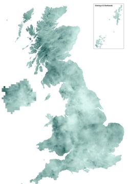
1km Rainfall Depth-Duration-Frequency Grids: Each grid gives point rainfall depth estimates in mm for a specified duration (hours) and return period (years). Grids are derived from the six-parameter FEH rainfall depth-duration-frequency (DDF) model as described in the Flood Estimation Handbook Volume 2.
Image

Technical Features
- Scale: 1km gridded dataset
- Available durations: 1 hour, 3 hours, 6 hours and 12 hours
- Available return periods: 2, 5, 10, 30, 50, 75, 100, 200, 1000 and 10,000 years
- Supply Format: Arc/Info Grid Ascii
- Coverage: UK
Related publications
Faulkner, D S 1999. Rainfall frequency estimation. Volume 2 of the Flood Estimation Handbook. UK Centre for Ecology & Hydrology.
Obtaining a licence
To obtain a licence, please contact the UKCEH Data Licensing Team by email or via our data request form:
Email: spatialdata@ceh.ac.uk