The UK Hydrological Outlook has undergone an upgrade in order to improve the accuracy of the hydrological forecast. Katie Facer-Childs and Steve Turner explain more...
The UK Hydrological Outlook, which has recently celebrated its 10-year anniversary, provides an insight into future hydrological conditions across the UK. Specifically, it describes likely trajectories for river flows and groundwater levels on a monthly basis, with a particular focus on the next three months.
The UK Hydrological Outlooks team have transitioned our meteorological based forecasts, or “river flow from rainfall forecasts” over to a new forecasting method provided by the Met Office, improving the spatial distribution of rainfall forecasts, and the predictability of winter river flow conditions driven by atmospheric circulation patterns (such as, for example, the North Atlantic Oscillation).
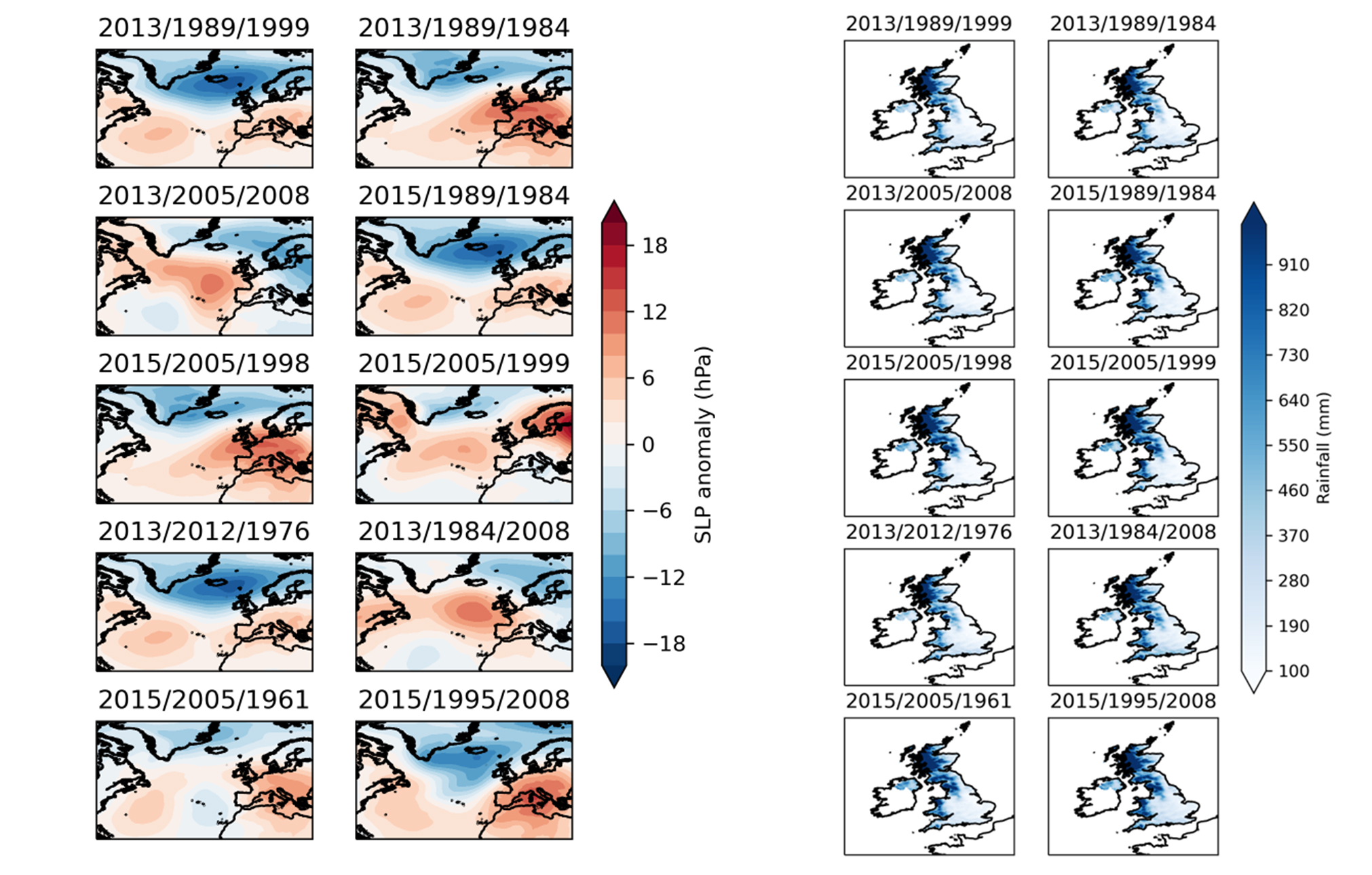
The historical weather analogues method uses Met Office predictions of average weather one and three months ahead as input to hydrological models. High-resolution weather observations from HadUK-Grid are used to provide finer spatial detail than directly produced by the Met Office forecast model.
This is achieved by seeking ‘analogues’ – periods in UK weather records with similar weather patterns to those predicted. The forecast period is split into thirds and observed data for each third is taken from different past years, having accounted for non-weather-related trends. The pool of all possible combinations creates the set of weather scenarios available for use as analogues to the forecast weather. The benefit of this ‘shuffling’ approach is that it gives a much larger selection for matching the forecast, meaning the method is not constrained by the limited number of observed years.
For each member of the Met Office forecast ensemble, the 10 analogues of shuffled weather data that best match the predicted average weather pattern (surface pressure map) over the whole forecast period are selected. These dates are then used to extract rainfall and temperature data to use as inputs to the catchment-based GR6J model and 1km Grid-to-Grid/Water Balance Models, creating ensembles of hydrological forecasts.
Initial assessments demonstrate considerable improvement in hydrological forecasts using these historic weather analogues over previous rainfall inputs, especially in winter and in the north-east, where predictability from initial hydrological conditions (and Ensemble Streamflow Prediction forecasts) is typically low.
The results of these new methods will be available in the monthly UK Hydrological Outlook PDF on the UK Hydrological Outlook website and can be explored interactively on the Outlooks portal. More information about the methods can also be found on the UK Hydrological Outlooks website.