Professional summary
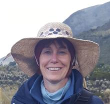
France has over 25 years of experience in remote sensing of vegetation and land in a wide range of ecosystems. She graduated at the University of Ghent Belgium as an Agricultural Engineer in Forestry and did an MSc in Environmental GIS and Remote Sensing at Aberdeen University. In her PhD she used 3-dimensional light-canopy interaction modelling to test if tree canopy shadowing could be used to differentiate tropical forest types on multi-view satellite imagery. Her work focuses on the development of remotely sensed-derived data to constrain and validate models, support process understanding and monitor vegetation. Using field radiometry, camera, drone, aircraft and satellite remote sensing, she and her team have worked on characterising wetland and flood dynamics, tropical leaf/plant phenology, woody cover and habitat condition, and on mapping land cover, forest types, vegetation communities, burnt area, plant species and flowers.
Throughout her career France has also managed a variety of interdisciplinary research projects. The NERC AHRC funded Newton project PARAGUAS (Colombia-Bio programme) is one of the most recent ones. PARAGUAS studied how the diversity of plants and activities of people contribute to the water regulation and provision of the Colombian páramos. The remote sensing part involved the mapping of páramo vegetation communities across 12 micro-catchments of Guántiva-La Rusia using drones. She is currently also managing the remote sensing work package of the Horizon2020 MAMBO project. The work package is responsible for developing pipelines extracting habitat condition metrics from 3 dimensional point clouds from drone LiDAR or Structure from motion data. As part of this MAMBO work package she is working on mapping individual hawthorn shrubs and their biomass. In the MRC-GCRF grants KFD and IndiaZooRisk, her team is characterising seasonal surface water and paddy dynamics and forest fragmentation across regions of India. In the CURFEW project she is exploring ways to separate and map plant life cycle stages of papyrus and phragmites.
