About HYRAD
HYRAD is an advanced weather radar display system for PCs, providing real-time receipt of radar and other hydrometeorological products, database and archiving facilities, and a hydrological processing kernel for improved rainfall estimation and forecasting. It also assesses rainfall rarity.
HYRAD is the standard radar display system for flood warning across England, Wales, Scotland, Northern Ireland and Belgium. It provides:
- real-time receipt of radar and other hydrometeorological products
- database and archiving facilities
- a hydrological processing kernel for improved rainfall estimation and forecasting
The HYRAD kernel pre-processes radar data to remove residual anomalies. It also forms more accurate rainfall estimates by merging radar and raingauge data, and constructs rainfall forecasts.
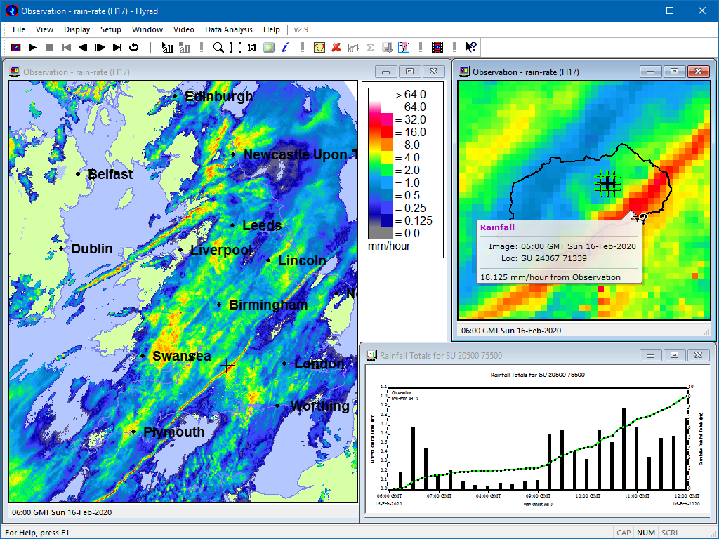
Catchment average time-series can be produced for all products. These time-series can be displayed in total and cumulative form as a guide to flooding risk. HYRAD can also pass the catchment averages through an automated interface to Flow Forecasting and Modelling Systems used in flood warning.
The quality-assured software operates as a resilient Client-Server system capable of serving hundreds of clients.

Functionality
HYRAD provides:
- real-time reception of weather radar products and other space-time gridded products such as potential evaporation, soil moisture, runoff, weather prediction model forecasts of rainfall and temperature
- configurable inclusion of radar products - such as single-site radar, national and European composites - and handling of different space-time resolutions and map projections
- system monitoring of real-time data reception
- an efficient database and archiving system
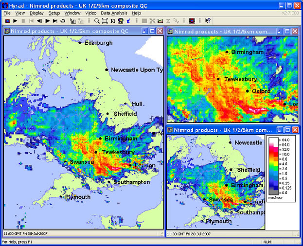
- static and animated display of images in multiple windows and with zoom and pan
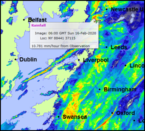
- user-configured overlays and underlays providing geographical context information, such as raingauge locations, river networks, catchment boundaries and coastlines
- display of cumulative product images over minutes, hours, days and months
- statistical analysis of product images for a selected point, rectangle or catchment
- rarity assessment of radar rainfall as a function of depth and duration using the industry standard Flood Estimation Handbook (FEH) methods
- calculation of catchment average product time-series for display and onward transmission to Flow Forecasting and Modelling Systems
- a Hydrological Processing kernel providing:
- radar pre-processing to correct for static anomalies and transient clutter
- more accurate rainfall estimation by merging radar and rainfall data
- radar rainfall forecasting
- calculation of space-time rainfall images from raingauge data alone
- a tool for creating composite or modified products by merging, averaging and cropping
- an automated interface to Flow Forecasting and Modelling Systems
System architecture
A client-server architecture is used in which the data reception, database system, archiving and Radar Hydrology Kernel software typically runs on a Linux or Windows server machine. PCs running Microsoft Windows 10 or later are used to support the Graphical User Interface and visualisation facilities of the HYRAD Display Client. The Client communicates with the Server over a LAN/WAN network.
Contact for further information
For further information on using HYRAD, please contact Bob Moore via the HyradSupport@ceh.ac.uk email.
Bob Moore
UK Centre for Ecology & Hydrology
Wallingford
OX10 8BB
United Kingdom
Telephone: +44(0)1491 692262